Campsite MÜLLERWIESE
Cycling - Mountainbiking - G P S

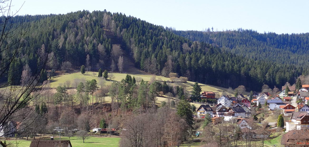
Holiday resort Enzklösterle - view of mount Hirschkopf
The campsite Müllerwiese can be your starting point for a lot of smaller or bigger cycling or mountainbiking tours through the surroundings of Enzklösterle, nature park Northern Black Forest.
It's a cyclist's dream: breathtaking climbs, speedy descents, technically demanding trails, varied terrain, GPS routing and well marked cycling trails for all difficulty levels from beginner to professional.
Also for families the terrain around Enzklösterle is ideal for easier tours through valleys or over the highlands with little difference in altitude.
Mountainbike-Arena Murg-/Enztal
Enzklösterle with the campsite Müllerwiese is the gateway to the new mountain biking stomping ground in the Black Forest: the mountain bike arena of Murg-/Enz valley.
It's a mountain biker's dream with around 800 kilometers of excellently marked mountain biking trails for all difficulty levels.
Routes to download as well as GPS-Tracks and descriptions of mountainbiking routes you will find in the internet on www.bikearena-murgenz.de or www.naturparkschwarzwald.de.
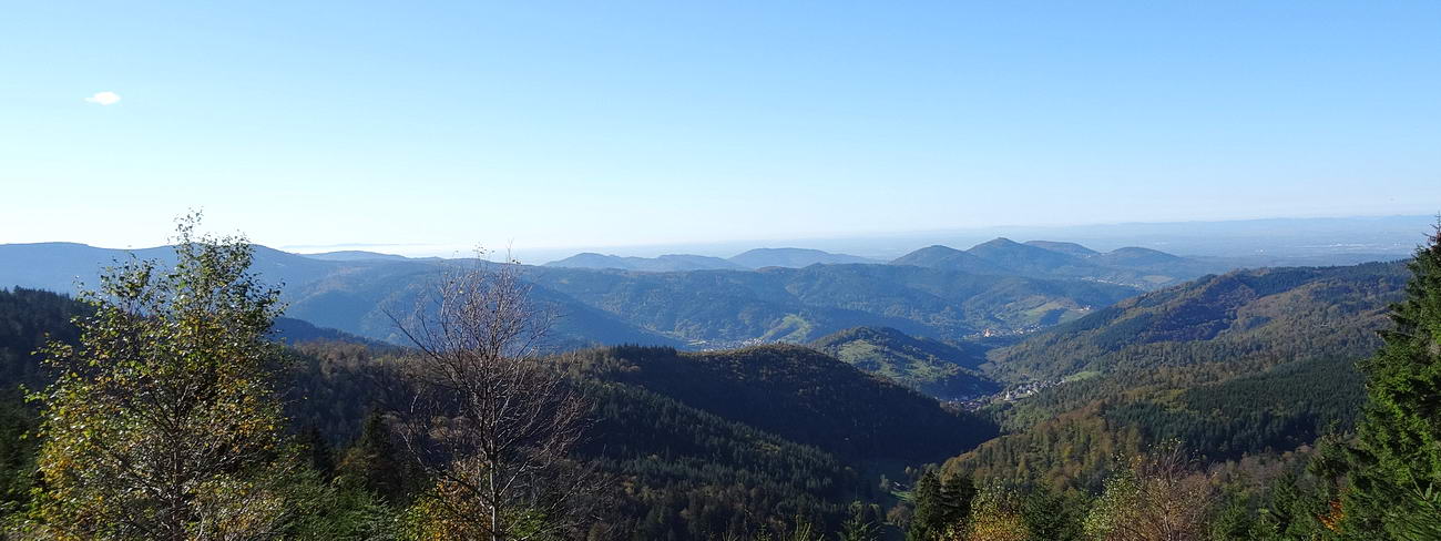
Mountains of the northern Black Forest nearby campsite Müllerwiese
Enz Valley bike trail
Woods, water and wine - these terms typify the Enz Valley bike trail.
The trail goes from the spring of the Enz river nearby campsite Müllerwiese to the estuary in the Neckar valley through a diverse cultural landscape:
Forested mountains, impressive river bends and valleys, rolling hills and vineyards all make up this beautiful area.
The signposted trail going through this area is about 115 km long and can be traversed comfortably by people of all age groups.
BIKEPARK
Downhill riding at its finest awaits you in the Bikepark of Bad Wildbad (12 km from the campsite Müllerwiese).
The landmark mountain of Bad Wildbad, the Sommerberg mountain, is considered a well kept secret of mountain biking fans.
The topography of the Sommerberg mountain, the mountain trail, and both ski lifts offer ideal conditions for fans of biker X, dual slalom, free ride, or downhill stretches.
Cycling Tours - GPS Tracks
In the following you will find a small part of the wide range of possible cycling tours through the northern Black Forest with starting point campsite Müllerwiese.
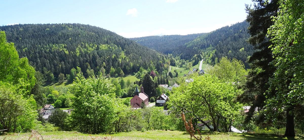
On mount Schneckenkopf: View of Enzklösterle and the Lappach valley
Cycling Tours for Families and untrained People
Destinations in Enzklösterle. In our village there are different possibilities for shorter cycling tours along the rivers Enz and Rohnbach with little difference in altitude.
From the campsite you can easily reach the little lakes "Kaltenbachsee" and "Poppelsee" (6 km) as well as the mountain slide and the childrens minipark at Poppeltal (5 km).
Also the Rohnbach valley offers an idyllic Black Forest landscape which is reachable by bicycle.
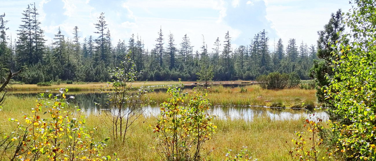
Nature reserve lake Hohloh (8km from the campsite)
Family Tour. Starting point Camping Müllerwiese (altitude 600m) - on the Enz Valley bike trail to Bad Wildbad - cable railway up the mount "Sommerberg" - Lehenhütte - Black Forest restaurant Grünhütte - Leonhardhütte - Schwarzmiss, Kaiser-Wilhelm tower (altitude 1000m), lake Hohloh - Viereichenhütte - Rombachhof - Enzklösterle: campsite Müllerwiese. Distance covered 38,5 km; elevation 380 m.
Look and print in alltrails - Family Tour: Enzklösterle - Hohloh
Forest Tours for trained Mountainbikers
Enz Marathon. The tour will lead you over the mighty mountains along the Enz Valley. Starting point campsite Müllerwiese (altitude 600m) - Gernsbacher Steige - Viereichenhütte - Hohloh tower (altitude 1000m) - lake "Wildsee" - mount "Sommerberg" - Bad Wildbad - Calmbach - mount Meistern - villages Meistern, Hünerberg, Aichelberg - back to Enzklösterle and campsite Müllerwiese. Distance covered 48,5 km; elevation 980 m.
Look and print in GPS-tour.info: Around the higher Enz valley.
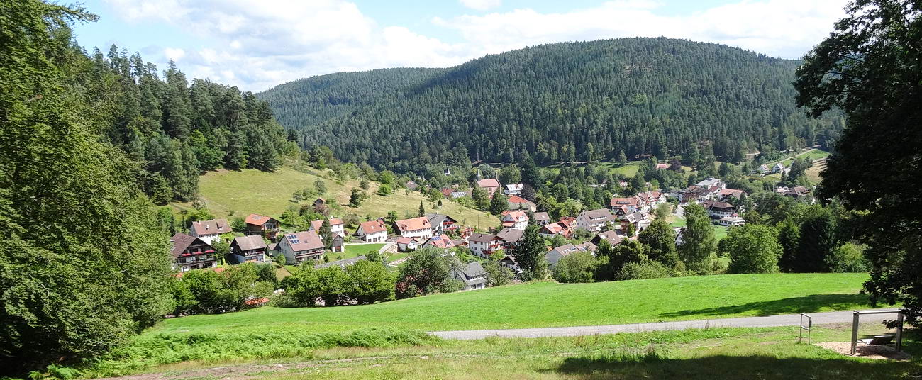
Enzklösterle, view of the village and the Gernsbacher Steige (left side with its houses)
"Athlete's Tour". Starting point campsite Müllerwiese (altitude 600m) - Rohnbach valley - Viereichenhütte - Schwarzmiss (altitude 933m) - Black Forest restaurant Grünhütte - Christophshof - Enzklösterle - campsite Müllerwiese.
Distance covered 33,5 km; elevation 570 m.
Look and print in GPS-tour.info: Enzklösterle-Grünhütte-Enzklösterle
"Hohloh Tour". Starting point campsite Müllerwiese (altitude 600m) - Rathausweg - Gompelscheuer - Schäuflerweg - Blockhaus Redoute - Schramberg - Alte Weinstrasse - Prinzenhütte - Kaiser-Wilhelm-Turm (altitude 1000m) - Schwarzmiss - Kaltenbronn - Fallenkopfweg - Sprollenmühle - Enztraufweg - Nonnenmiss - Enzklösterle - campsite Müllerwiese. Distance covered 31 km; elevation 580 m.
GPS-Track Download: Hohloh Tour in .gpx-Format
(Set cursor on the link above - press right mouse key - save as ...)
"Enzklösterle - Hohloh - Enzklösterle". Starting point campsite Müllerwiese (altitude 600m) - Hirschtalweg - Rindenhütte - Gernsbacher Steige - Viereichenhütte - Diebstichweg - Auerhahnenstein - Torfweg - Kaiser-Wilhelm-Turm (altitude 1000m) - Prinzenhütte - Latschigfelsen - Kauersbachberg - Eulstein - Blockhaus Läger - Toter Mann - Schramberg - Blockhaus Redoute - Schäuflerweg - Schrambergweg - Hirschbrunnenhütte - Rombachhof - Rohnbach valley - Enzklösterle, campsite Müllerwiese. Distance covered 38 km; elevation 870 m.
GPS-Track Download: Hohloh Tour in .gpx-Format
(Set cursor on the link above - press right mouse key - save as ...)
"Kleine Enz Valley". Starting point campsite Müllerwiese (altitude 600m) - Rathausweg - Gompelscheuer - Enzwald (altitude 870m) - crossing the road Enzklösterle Simmersfeld - Wilhelm-Maurer-Hütte - Kleine Enz Valley - Rehmühle - Kleinenzhof - Calmbach - mount Meistern - Judenweg - Butterhütte - Meistern - Hünerberg - Aichelberg - Herzogsbank - Enzklösterle, campsite Müllerwiese. Distance covered 48 km; elevation 830 m.
GPS-Track Download: Kleine Enz Valley in .gpx-Format
(Set cursor on the link above - press right mouse key - save as ...)
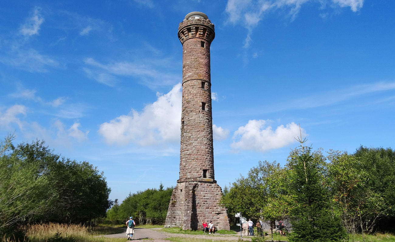
Kaiser-Wilhelm-Tower (about 1000m altitude), 8 km from campsite Müllerwiese away
"Murg Valley Tour" and to the Black Forest National Park. Starting point Camping Müllerwiese (altitude 600m) - Bergweg - Rohnbach valley - Rombachhof - Schultheissweg - Prinzenhütte (alt. 950m) - Latschighütte - Gausbach - Forbach - Bermersbach - Ruhberghütte - Rote Lache - Badener Höhe - Black Forest National Park - Seekopf - Schwarzenbach reservoir - Raumünzach - crossing river Murg - Kaltenbach - Kotwaldweg - Kaltenbachweg - Neuhaushütte - Lägerhalde - Gompelscheuer - Enzklösterle - Rathausweg - campsite Müllerwiese. Distance covered 60 km; elevation 1800 m.
Look and print in Murgtal-Tour
"Besenfeld - Mount Hohloh". Starting point Campsite Müllerwiese at Enzklösterle (altitude 600 m) - up the Enz valley - Gompelscheuer - Poppeltal - Mountain plateau nearby Seewald-Besenfeld (altitude 900 m) - Neuhaus - Black Forest hiking/ cycling- trail "Mittelweg" - Nature reserve lake Hohloh - Emperor-Wilhelm-Tower (altitude 1000 m) - Viereichenhütte - Mount Hirschkopf - "Erdbeerplatte" - Camping Müllerwiese. Distance covered 38 km; elevation 870 m
Look and print in Enzklösterle - Besenfeld - Hohloh - Enzklösterle
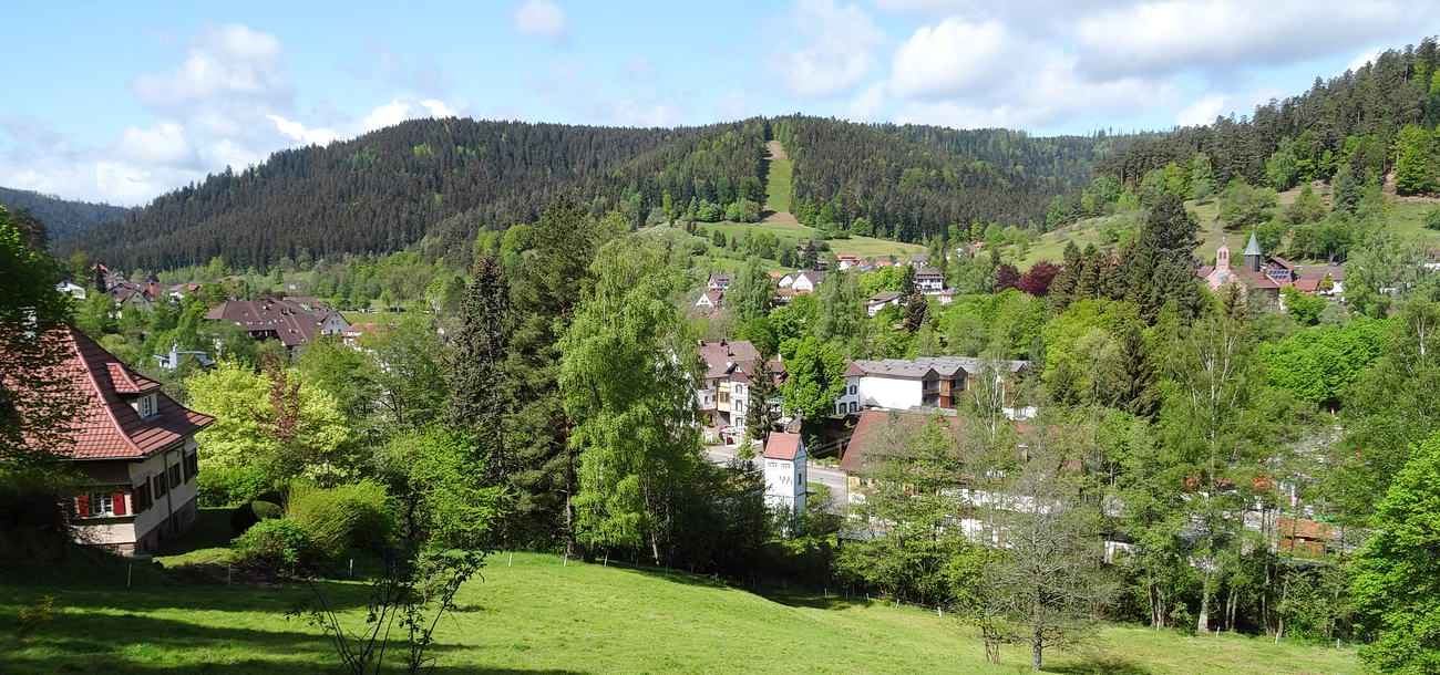
Holiday resort Enzklösterle, view over the village
Further GPS Mountainbike-Tours with starting point at ENZKLÖSTERLE
Camping Müllerwiese at Enzklösterle - Bad Wildbad in the Black Forest - Gernsbach - Enzklösterle (67 km) in www.alltrails.com
Tourist Info at Enzklösterle - Hohloh - Besenfeld - Christophshof - Enzklösterle (52 km) in www.alltrails.com
Camping Müllerwiese at Enzklösterle - Aichelberg - Calmbach - Bad Wildbad - Hohloh - Enzklösterle (48 km) in www.alltrails.com
Enzklösterle - Schwarzenbachtalsperre - Black Forest National Park - Enzklösterle (81 km) in www.alltrails.com
TOURS FOR RACING CYCLISTS
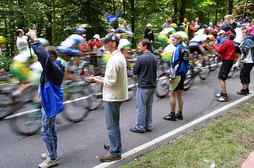
Tour de France 2005 - Etappe in the northern Black Forest
Enzklösterle-Forbach-Kaltenbronn-Enzklösterle. Starting point campsite Müllerwiese - Gompelscheuer - Poppeltal - B 294 - Besenfeld - Schönegründer Steige (Murg valley) - B 462 - Forbach - Hilpertsau - Reichental - Schwarzmiss - Kaltenbronn - Sprollenhaus - Nonnenmiss - Enzklösterle, campsite Müllerwiese. Distance covered 63,5 km; elevation 1160 m.
Look and print in GPS-tour.info
Enz-Nagold-Plateau. Starting point campsite Müllerwiese - Gompelscheuer - Poppeltal - B 294 - Simmersfeld on the Enz-Nagold-Plateau - Aichhalden - Zwerenberg - Martinsmoos - Wart - Rotfelden - Effringen - Schönbronn - Martinsmoos - Neuweiler - Hofstett - Aichhalden - Simmersfeld - Enzklösterle - campsite Müllerwiese. Distance covered 64 km; elevation 830 m.
Look and print in GPS-tour.info
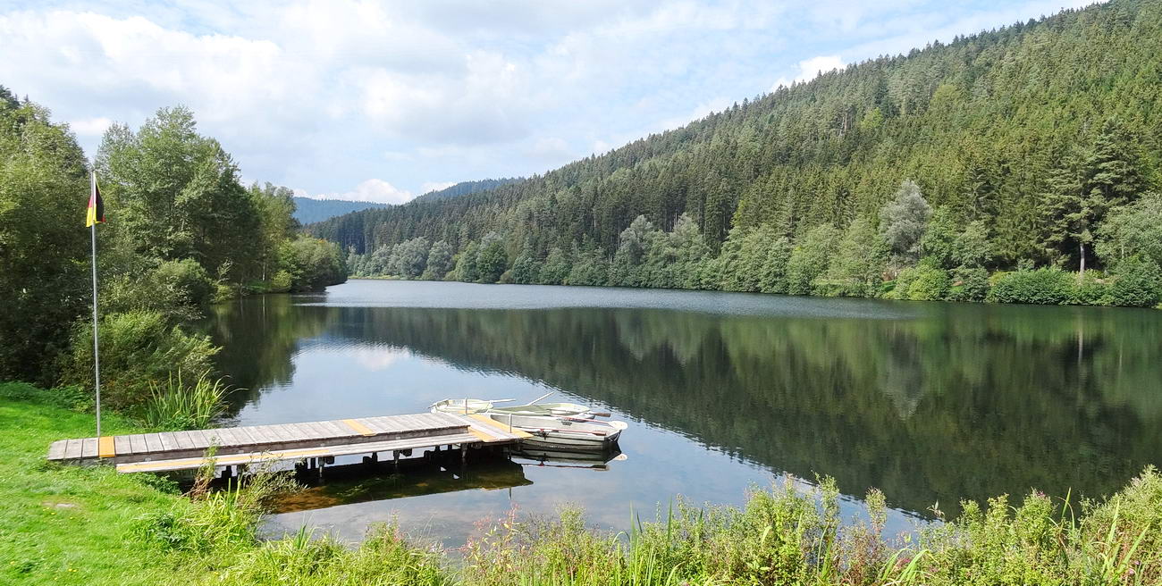
River Nagold reservoir, 15 km from campsite Müllerwiese
5 Mountains. Starting point campsite Müllerwiese - Poppeltal - B 294 - Göttelfingen - Seewald-Erzgrube at river Nagold reservoir - Kälberbronn - Pfalzgrafenweiler - Baisingen - Oberschwandorf - Egenhausen - Altensteig - Berneck - Hornberg - Zwerenberg - Neuweiler - Aichelberg - Bad Wildbad-Lautenhof - Enzklösterle, campsite Müllerwiese. Distance covered 94 km; elevation 1410 m.
Look and print in GPS-tour.info
Further GPS Tours for Racing Cyclists
Enzklösterle - Murg Valley - Black Forest High Altitude Panorama Road - Nagoldtalsperre - Enzklösterle (117 km) in www.alltrails.com
Enzklösterle - Bad Wildbad in the Black Forest - Enz-Nagold-Plateau - Simmersfeld - Enzklösterle (67 km) in www.alltrails.com
Enzklösterle - Bad Wildbad - Bad Herrenalb - Gaggenau - Enzklösterle (97 km) in www.alltrails.com
Enzklösterle - Kaltenbronn - Weisenbach - Forbach - Besenfeld - Enzklösterle (80 km) in www.alltrails.com
Enzklösterle - Bad Teinach - Schömberg - Bad Wildbad in the Black Forest - Enzklösterle (83 km) in www.alltrails.com
Enzklösterle - Poppeltal - Pfalzgrafenweiler - Haiterbach - Altensteig - Enzklösterle (88 km) in www.alltrails.com
Enzklösterle - Murg Valley - Black Forest High Altitude Panorama Road - Black Forest National Park - Ottenhoefen - Baiersbronn - Bad Rippoldsau - Freudenstadt - Nagoldtalsperre - Enzklösterle (141 km) in www.alltrails.com
Enzklösterle - Murg Valley - Black Forest High Altitude Panorama Road - Black Forest National Park - Freudenstadt - Nagoldtalsperre - Simmersfeld - Enzklösterle (130 km) in www.alltrails.com
Black Forest brochure on bicycle tours to download
Further information on cycling you will find in the internet site www.enzkloesterle.de und auf outdooractive.com/
 2 / 2018
Imprint / Data protection


 2 / 2018


